Postcode 145001 - Pathankot, Punjab (India)
| Grootste stad | Pathankot |
| Gebied van Postcode 145001 | 99 km² |
| Bevolking | 204,289 |
| Mannelijke bevolking | 109,540 (53.6%) |
| Vrouwelijke bevolking | 94,749 (46.4%) |
| Bevolkingsverandering van 1975 tot 2015 | +37.1% |
| Bevolkingsverandering van 2000 tot 2015 | -1.9% |
| Gemiddelde leeftijd | 27.2 jaren |
| Gemiddelde leeftijd bij de mannen | 26.2 jaren |
| Gemiddelde leeftijd bij de vrouwen | 28.3 jaren |
| Netnummers | 186 |
| Buurten | Gandhi Chowk, Jodhamal Bagh, Jodhamal Colony, Mamun, Model Town, Patel Chowk, Ramlila Ground, Sarain Mohalla |
| Timezone | India Standard Time |
| coördinaten | 32.29479309890886° / 75.7072225125089° |
| Gerelateerde Postcodes | 145021, 145022, 145023, 145024, 145025, 145026, 145027, 145029, 145101, 146001 |
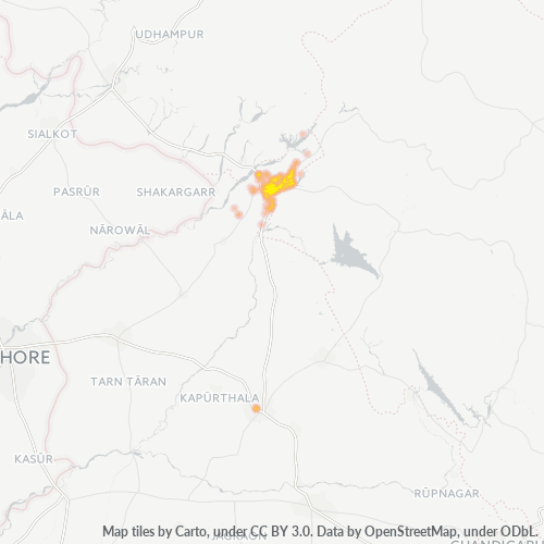
Kaart van Postcode 145001 - Pathankot, Punjab (India)
Interactieve kaart
Bevolking van Postcode 145001 - Pathankot, Punjab (India)
Jaren 1975 tot 2020
| Data | 1975 | 1990 | 2000 | 2015 | 2020 |
|---|---|---|---|---|---|
| Bevolking | 149.061 | 186.227 | 208.155 | 204.289 | 216.108 |
| Bevolkingsdichtheid | 1.506,3 / km² | 1.881,9 / km² | 2.103,5 / km² | 2.064,4 / km² | 2.183,8 / km² |
Bevolkingsverandering van Postcode 145001 - Pathankot, Punjab (India) van 2000 tot 2015
Daling van 1.9% van jaar 2000 tot 2015
| Locatie | Verandering sinds 1975 | Verandering sinds 1990 | Verandering sinds 2000 |
|---|---|---|---|
| Postcode 145001 - Pathankot, Punjab (India) | +37.1% | +9.7% | -1.9% |
| Pathankot | +11.4% | -7.6% | -10.1% |
| Punjab (India) | +89.5% | +40% | +18.4% |
| India | +111.1% | +50.6% | +24.5% |
Mediane leeftijd in Postcode 145001 - Pathankot, Punjab (India)
Mediane leeftijd: 27.2 jaar
| Locatie | Gemiddelde leeftijd | Mediane leeftijd (vrouw) | Mediane leeftijd (mannelijk) |
|---|---|---|---|
| Postcode 145001 - Pathankot, Punjab (India) | 27.2 yrs | 28.3 yrs | 26.2 yrs |
| Pathankot | 27.2 yrs | 28.3 yrs | 26.2 yrs |
| Punjab (India) | 27.3 yrs | 28.3 yrs | 26.4 yrs |
| India | 24.9 yrs | 25.4 yrs | 24.5 yrs |
Bevolkingsdichtheid van Postcode 145001
Bevolkingsdichtheid: 2.064 / km²
| Locatie | Bevolking | Gebied | Dichtheid |
|---|---|---|---|
| Postcode 145001 | 204.289 | 99 km² | 2.064 / km² |
| Pathankot | 222.015 | 18,2 km² | 12.218 / km² |
| Punjab (India) | 31,2 million | 50.426,7 km² | 619 / km² |
| India | 1.307 million | 3.083.563,4 km² | 424 / km² |
Historische en geprojecteerde bevolking van Postcode 145001 - Pathankot, Punjab (India)
Geschatte bevolking van 0 tot 2100
- JRC (European Commission's Joint Research Centre) werken aan de GHS built-up grid
- CIESIN (Center for International Earth Science Information Network)
- [Link] Klein Goldewijk, K., Beusen, A., Doelman, J., and Stehfest, E.: Anthropogenic land use estimates for the Holocene – HYDE 3.2, Earth Syst. Sci. Data, 9, 927–953, https://doi.org/10.5194/essd-9-927-2017, 2017.
Industries
Bedrijfsdistributie per sector in Postcode 145001 - Pathankot, Punjab (India)
| Industrie omschrijving | Aantal bedrijven |
|---|---|
| Autogarage | 185 |
| Buurtwinkels en supermarkten | 250 |
| Electronicawinkel | 353 |
| Fastfoodrestaurants | 178 |
| Ijzerhandel | 220 |
| Kledingwinkels | 606 |
| Onderwijs | 232 |
| Restaurants | 412 |
| Winkelen | 636 |
| Winkelen Overig | 516 |
Human Development Index (HDI)
Statistische samengestelde index van levensverwachting, opleiding en inkomen per hoofd van de bevolking.
CO2-uitstoot van Postcode 145001
Kooldioxide (CO2) -emissies per hoofd van de bevolking in ton per jaar
| Locatie | CO2 uitstoot | CO2-uitstoot per hoofd van de bevolking | CO2-emissie-intensiteit |
|---|---|---|---|
| Postcode 145001 | 406,650 tn | 1.99 tn | 4,109.3 tons/km² |
| Pathankot | 455,569 tn | 2.05 tn | 25,070.4 tons/km² |
| Punjab (India) | 58,878,713 tn | 1.89 tn | 1,167.6 tons/km² |
| India | 1,928,568,344 tn | 1.48 tn | 625.4 tons/km² |
| CO2-uitstoot 2013 (ton/jaar) | 406,650 tn |
| CO2-uitstoot 2013 (ton/jaar) per hoofd van de bevolking | 1.99 tn |
| CO2-uitstootintensiteit 2013 (ton/km²/jaar) | 4,109.3 tons/km² |
Natuurlijk gevarenrisico
Relatief risico op 10
| Gevaar | Risiconiveau |
|---|---|
| Droogte | Gemiddeld (7) |
| Overstroming | Hoog (9) |
| Aardbeving | Gemiddeld (6.6) |
Recente aardbevingen in de buurt
Magnitude 3.0 en hoger
| Datum▼ | Tijd↕ | Magnitude↕ | Distance↕ | Diepte↕ | Locatie↕ | Link |
|---|---|---|---|---|---|---|
| 7/24/19 | 12:17 PM | 4.2 | 80.2 km | 10,000 m | 30km NE of Chamba, India | usgs.gov |
| 6/14/18 | 3:15 AM | 4.5 | 68.2 km | 10,000 m | 21km E of Chamba, India | usgs.gov |
| 5/6/18 | 12:46 AM | 4.1 | 75.7 km | 41,610 m | 34km N of Chamba, India | usgs.gov |
| 3/15/18 | 7:53 AM | 4.5 | 89.5 km | 39,800 m | 36km E of Bhadarwah, India | usgs.gov |
| 8/15/17 | 8:26 PM | 4.4 | 81.5 km | 44,780 m | 35km NNE of Chamba, India | usgs.gov |
| 5/19/17 | 10:48 PM | 4.2 | 84.5 km | 35,360 m | 36km NNE of Chamba, India | usgs.gov |
| 5/18/17 | 5:02 PM | 4.5 | 90.3 km | 42,990 m | 40km E of Bhadarwah, India | usgs.gov |
| 5/24/16 | 3:17 AM | 4.1 | 93.9 km | 35,000 m | 36km ENE of Bhadarwah, India | usgs.gov |
| 2/9/16 | 7:13 AM | 4.2 | 85 km | 40,200 m | 33km E of Bhadarwah, India | usgs.gov |
| 2/3/16 | 11:10 PM | 4.3 | 68.7 km | 58,670 m | 32km NNW of Chamba, India | usgs.gov |
Grootste stad
Pathankot is een stad in het uiterste noorden van de Indiase deelstaat Punjab. De stad is vooral belangrijk als verkeersknooppunt, en heeft daarom ook een grote strategische waarde in de conflicten tussen India en Pakistan.
Pathankot Wikipedia Page
Over onze gegevens
De gegevens op deze pagina zijn geschat met behulp van diverse openbaar beschikbare tools en bronnen. Ze worden aangeboden zonder garantie en kunnen onnauwkeurigheden bevatten. Gebruik op eigen risico.