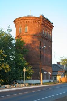
Postcode 171210 - Lichoslavl, Oblast Tver
Oblast Tver | Rusland
| Grootste stad | Lichoslavl |
| Bevolking | 12,290 |
| Timezone | Moscow Standard Time |
| coördinaten | 57.12486590117945° / 35.46187111993296° |
| Gerelateerde Postcodes | 171200, 171201, 171202, 171205, 171206, 171215, 171216, 171218, 171219, 171225 |
Kaart van Postcode 171210 - Lichoslavl, Oblast Tver
Interactieve kaart
Bevolkingsdichtheid van Lichoslavl
Bevolkingsdichtheid: 1.881 / km²
| Locatie | Bevolking | Gebied | Dichtheid |
|---|---|---|---|
| Lichoslavl | 12.885 | 6,9 km² | 1.881 / km² |
| Oblast Tver | 1,3 million | 84.493,7 km² | 15,2 / km² |
| Rusland | 145,3 million | 16.974.452,8 km² | 8,6 / km² |
Bronnen: JRC (European Commission's Joint Research Centre) werken aan de GHS-bebouwingsraster
Netnummers
Percentage gebiedscodes gebruikt door bedrijven in Postcode 171210 - Lichoslavl, Oblast Tver
Industries
Bedrijfsdistributie per sector in Postcode 171210 - Lichoslavl, Oblast Tver
| Industrie omschrijving | Aantal bedrijven |
|---|---|
| Apotheken | 11 |
| Banken | 6 |
| Benzinestation | 5 |
| Buurtwinkels en supermarkten | 12 |
| Groothandel bouwmaterialen | 5 |
| Ijzerhandel | 6 |
| Onderwijs | 15 |
| Onroerend Goed | 8 |
| Openbaar bestuur | 6 |
| PIN-automaten | 7 |
| Schoonheidsalons | 5 |
| Winkelen | 26 |
CO2-uitstoot van Lichoslavl
Kooldioxide (CO2) -emissies per hoofd van de bevolking in ton per jaar
| Locatie | CO2 uitstoot | CO2-uitstoot per hoofd van de bevolking | CO2-emissie-intensiteit |
|---|---|---|---|
| Lichoslavl | 115,347 tn | 8.95 tn | 16,837.2 tons/km² |
| Oblast Tver | 10,816,673 tn | 8.43 tn | 128 tons/km² |
| Rusland | 1,356,388,647 tn | 9.34 tn | 79.9 tons/km² |
Bronnen: [Link] Moran, D., Kanemoto K; Jiborn, M., Wood, R., Többen, J., and Seto, K.C. (2018) Carbon footprints of 13,000 cities. Environmental Research Letters DOI: 10.1088/1748-9326/aac72a
CO2-uitstoot van Lichoslavl
| CO2-uitstoot 2013 (ton/jaar) | 115,347 tn |
| CO2-uitstoot 2013 (ton/jaar) per hoofd van de bevolking | 8.95 tn |
| CO2-uitstootintensiteit 2013 (ton/km²/jaar) | 16,837.2 tons/km² |
Grootste stad
Lichoslavl (Russisch: Лихославль) is een stad in de Russische oblast Tver. De stad ligt 41 kilometer ten noordwesten van Tver, aan de spoorlijn tussen Sint-Petersburg en Moskou. Lichoslavl is de hoofdplaats van het gelijknamige bestuurlijke rayon. De stad heef..
Lichoslavl Wikipedia Page