Postcode 170 - Tokyo Prefecture
Tokyo Prefecture | Japan
| Bevolking | 12,445,327 |
| Netnummers | 1395, 1396, 23, 236 |
| Postcode-uitbreidingen | 170-0000, 170-0001, 170-0002, 170-0003, 170-0004, 170-0005, 170-0011, 170-0012, 170-0013, 170-0014 More |
| Vergelijkbare steden | Tokio, Minamisenju |
| Buurten | Higashiikebukuro, 1 Chome, Higashiikebukuro, 3 Chome, Kitaotsuka, 2 Chome, Minamiotsuka, 3 Chome, Ōtsuka, Sugamo, 1 Chome |
| Timezone | Japan Standard Time |
| coördinaten | 35.73569999928012° / 139.72919999907307° |
| Gerelateerde Postcodes | 160, 161, 171, 173, 174, 175, 176, 177, 178, 179 |
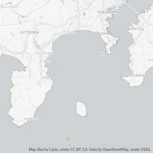
Kaart van Postcode 170 - Tokyo Prefecture
Interactieve kaart
Bevolkingsdichtheid van Tokyo Prefecture
Bevolkingsdichtheid: 6.171 / km²
| Locatie | Bevolking | Gebied | Dichtheid |
|---|---|---|---|
| Tokyo Prefecture | 13,5 million | 2.187,1 km² | 6.171 / km² |
| Japan | 122,9 million | 373.410,9 km² | 329 / km² |
Bronnen: JRC (European Commission's Joint Research Centre) werken aan de GHS-bebouwingsraster
Bedrijfsconcentratie in Postcode 170 - Tokyo Prefecture
Industries
Bedrijfsdistributie per sector in Postcode 170 - Tokyo Prefecture
| Industrie omschrijving | Aantal bedrijven | Gemiddelde Google-beoordeling |
|---|---|---|
| Accountants | 115 | 3.4 |
| Advocaten/juristen | 156 | 3.6 |
| Algemene Aannemers | 106 | 3.4 |
| Alle eten en drinken | 427 | 3.8 |
| Apotheken | 129 | 3.8 |
| Bars en café's | 282 | 3.8 |
| Buurtwinkels en supermarkten | 187 | 3.8 |
| Café's | 223 | 3.7 |
| Electronicawinkel | 160 | 3.7 |
| Gemakswinkels | 128 | 3.5 |
| Japanse restaurants | 410 | 3.8 |
| Kappers | 242 | 4 |
| Kledingwinkels | 128 | 3.7 |
| Lening Bedrijven | 223 | 3.4 |
| Medisch en gezondheid | 423 | 3.5 |
| Onderwijs | 263 | 3.6 |
| Onroerend Goed | 299 | 3.8 |
| Openbaar bestuur | 127 | 3.8 |
| Overige accommodatie | 113 | 3.8 |
| Restaurants | 1,602 | 3.8 |
| Schoonheidsalons | 325 | 4 |
| Tandartsen | 159 | 3.8 |
| Winkelen | 1,423 | 3.8 |
Bedrijfsspreiding voor Postcode 170 - Tokyo Prefecture
CO2-uitstoot van Tokyo Prefecture
Kooldioxide (CO2) -emissies per hoofd van de bevolking in ton per jaar
| Locatie | CO2 uitstoot | CO2-uitstoot per hoofd van de bevolking | CO2-emissie-intensiteit |
|---|---|---|---|
| Tokyo Prefecture | 39,078,799 tn | 2.9 tn | 17,867.9 tons/km² |
| Japan | 541,995,101 tn | 4.41 tn | 1,451.5 tons/km² |
Bronnen: [Link] Moran, D., Kanemoto K; Jiborn, M., Wood, R., Többen, J., and Seto, K.C. (2018) Carbon footprints of 13,000 cities. Environmental Research Letters DOI: 10.1088/1748-9326/aac72a
CO2-uitstoot van Tokyo Prefecture
| CO2-uitstoot 2013 (ton/jaar) | 39,078,799 tn |
| CO2-uitstoot 2013 (ton/jaar) per hoofd van de bevolking | 2.9 tn |
| CO2-uitstootintensiteit 2013 (ton/km²/jaar) | 17,867.9 tons/km² |
Recente aardbevingen in de buurt
Magnitude 3.0 en hoger
| Datum▼ | Tijd↕ | Magnitude↕ | Distance↕ | Diepte↕ | Locatie↕ | Link |
|---|---|---|---|---|---|---|
| 7/3/19 | 5:04 PM | 4.4 | 39 km | 76,000 m | 2km N of Ichihara, Japan | usgs.gov |
| 12/29/18 | 9:16 PM | 4.2 | 41.4 km | 112,470 m | 3km SW of Minami-rinkan, Japan | usgs.gov |
| 11/26/18 | 3:33 PM | 4.8 | 37.2 km | 54,190 m | 3km E of Satte, Japan | usgs.gov |
| 9/18/18 | 1:11 AM | 4.6 | 31.9 km | 83,530 m | 3km ESE of Sugito, Japan | usgs.gov |
| 8/20/18 | 10:47 AM | 4.5 | 33.8 km | 55,150 m | 4km SW of Mitsukaido, Japan | usgs.gov |
| 7/28/18 | 11:21 PM | 3.2 | 36.7 km | 73,140 m | 2km WSW of Iwai, Japan | usgs.gov |
| 7/4/18 | 4:54 PM | 4.4 | 36.3 km | 81,290 m | 5km NNW of Ichihara, Japan | usgs.gov |
| 5/5/18 | 7:46 AM | 4.2 | 41.5 km | 73,210 m | 4km W of Ushiku, Japan | usgs.gov |
| 5/3/18 | 10:17 AM | 4.4 | 38.7 km | 66,500 m | 1km NNE of Chiba-shi, Japan | usgs.gov |
| 3/26/18 | 2:44 AM | 4.3 | 41.6 km | 65,390 m | 5km NNW of Iwai, Japan | usgs.gov |
1-10 of 500 tonen...
…
Postcode-uitbreidingen (73)